
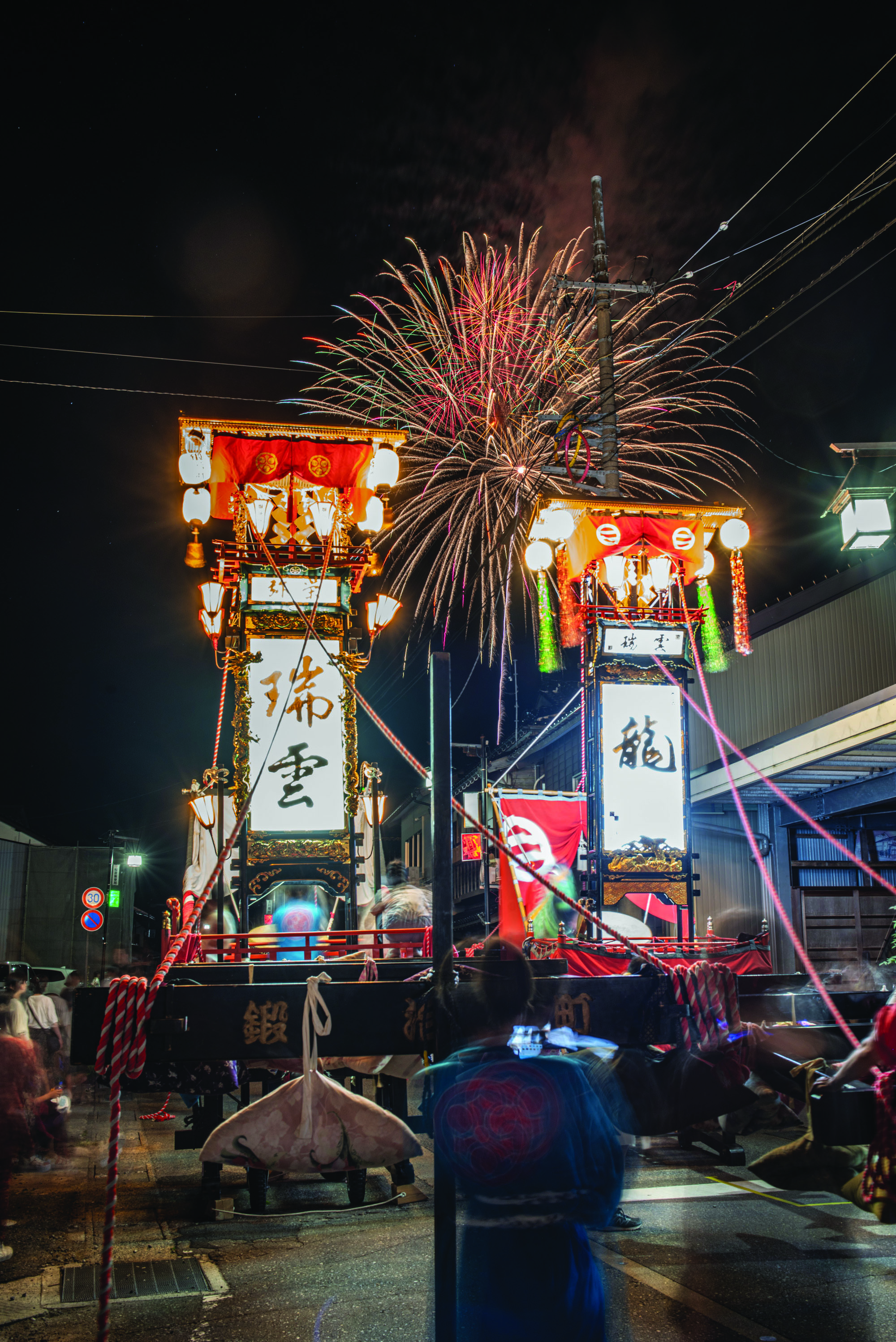
The NOW Institute proposes a comprehensive resilience strategy integrating disaster-resistant master planning with economic revitalization through cultural assets: Wajima lacquerware, the Kiriko festival, and world-class agriculture including seafood and Wagyu beef. This publication presents an integrated approach leveraging Oku-Noto's heritage to catalyze spatial disaster planning across three scales — regional planning, urban design, and architectural speculation.
The Noto Peninsula sits on the Sea of Japan in central Honshu: 2,404 square kilometers across 13 municipalities, the largest peninsula on that coast. Rich culture and resources — hot springs, artisan crafts, major festivals — have made it a Globally Important Agricultural Heritage System since 2011, a living model of ecological balance and cultural continuity for over 6,000 years.
Like many rural areas in Japan, Noto has faced serious challenges in recent years: depopulation, the decline of local industries, and a shrinking base of infrastructure to serve the communities left behind.
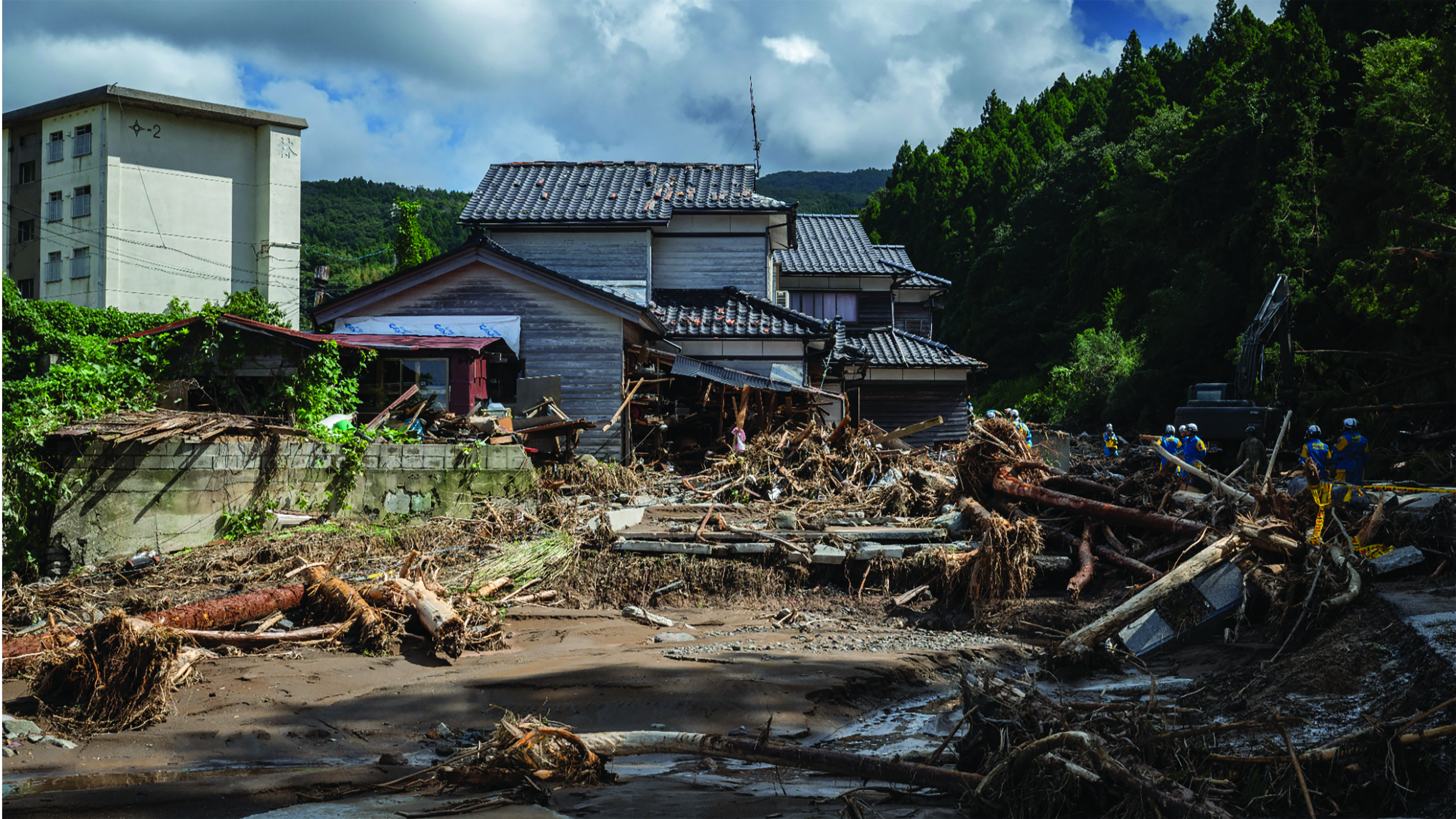
In 2024, the peninsula was devastated by two natural disasters eight months apart. On January 1, a magnitude 7.6 earthquake struck the region, with Wajima and Suzu among the hardest hit; the accompanying tsunami compounded the damage. In September, as recovery was underway, a severe rainstorm caused major flooding and landslides.
Recovery has been slow, but the process marks the beginning of a new Noto — one that can model how other regions reinvigorate their communities and build sustainable local economies, by introducing thoughtful urban planning and fostering equitable, functional communities.
The NOW Institute proposes a comprehensive resilience strategy integrating disaster-resistant master planning with economic revitalization through cultural assets: Wajima lacquerware, the Kiriko festival, and world-class agriculture including seafood and Wagyu beef. This project presents an integrated approach leveraging Oku-Noto's heritage to catalyze spatial disaster planning across three scales — regional planning, urban design, and architectural speculation.
The Noto Peninsula has been grappling with substantial delays in restoring vital infrastructure. Many roads remain blocked by debris and landslides; around 19,000 households still lacked running water two months after the quake; and as of June 2024, only about 12% of applications for publicly funded demolition had been started.
Housing recovery is proceeding slowly. More than 70% of evacuees remain worried about their future housing arrangements, and permanent reconstruction remains months or years away for many.
Economically, the region is under strain: core industries — agriculture, fishing, tourism — have been hit hard, and more than 60% of residents in the hardest-hit municipalities feel the recovery has barely progressed.
Earthquake: January 1, 2024. Following weeks — 85 key roads closed, ongoing landslides. September 21, 2024 — severe flooding. Recovery — ongoing, uneven, sustained by local solidarity.
By weaving three layers into a unified strategy, the plan aims to improve mobility, create meaningful jobs that help stem rural flight, and leverage tourism as a reliable source of financial revitalization.
1. Urban Planning
Future planning efforts focus on resilience: integrating disaster-preparedness, sustainable infrastructure, and revitalization strategies for aging and declining populations.
2. Regional Attributes
Towns and villages preserve a strong sense of tradition, reflected in local festivals and long-standing craft practices.
3. Noto Peninsula Resources
The peninsula is rich in natural resources: fertile farmland and a long, diverse coastline supporting fishing and aquaculture, recognized by UNESCO. These environmental assets form the foundation for sustainable recovery, tourism, and community revitalization.
Four Regional Strategies for Ishikawa
.svg)
Three Urban Strategies for Wajima — Flood Control (upstream sponge parks, floating villages) / Earthquake Planning (500m firebreak grid, four emergency-shelter anchors) / Cultural Route (Kiriko–Food–Shrines)
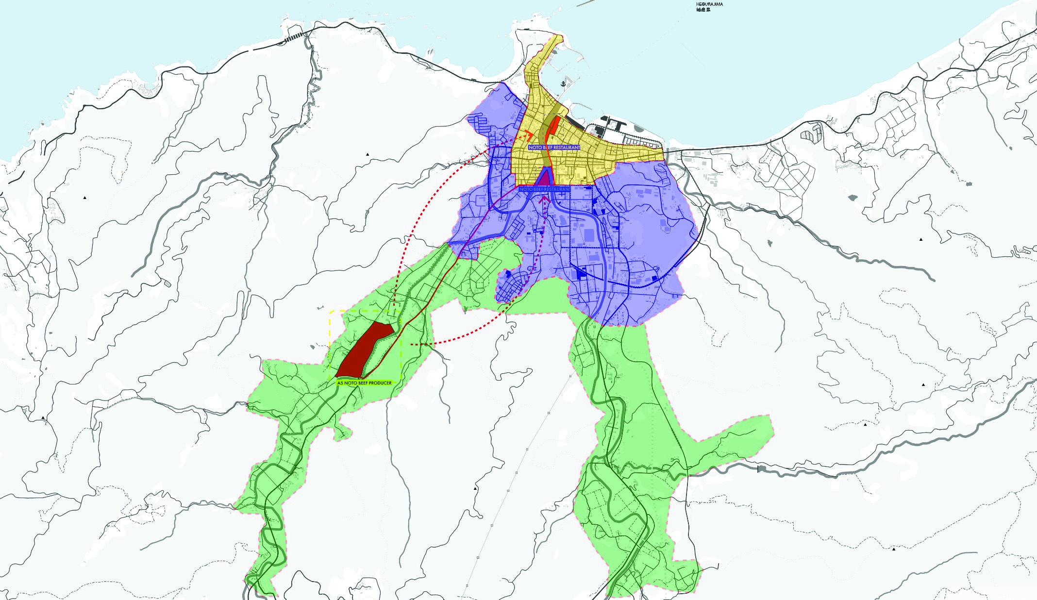
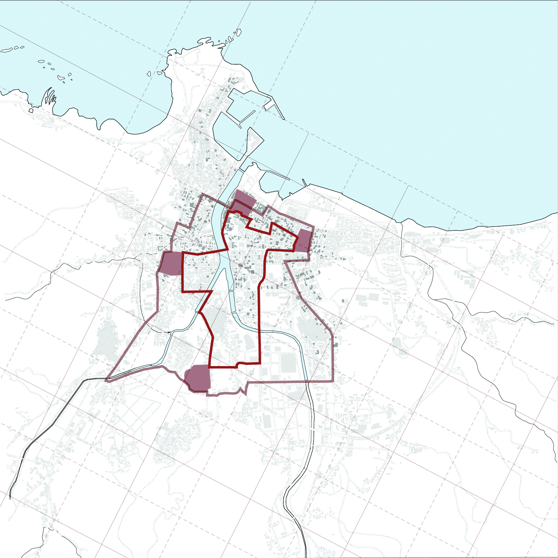
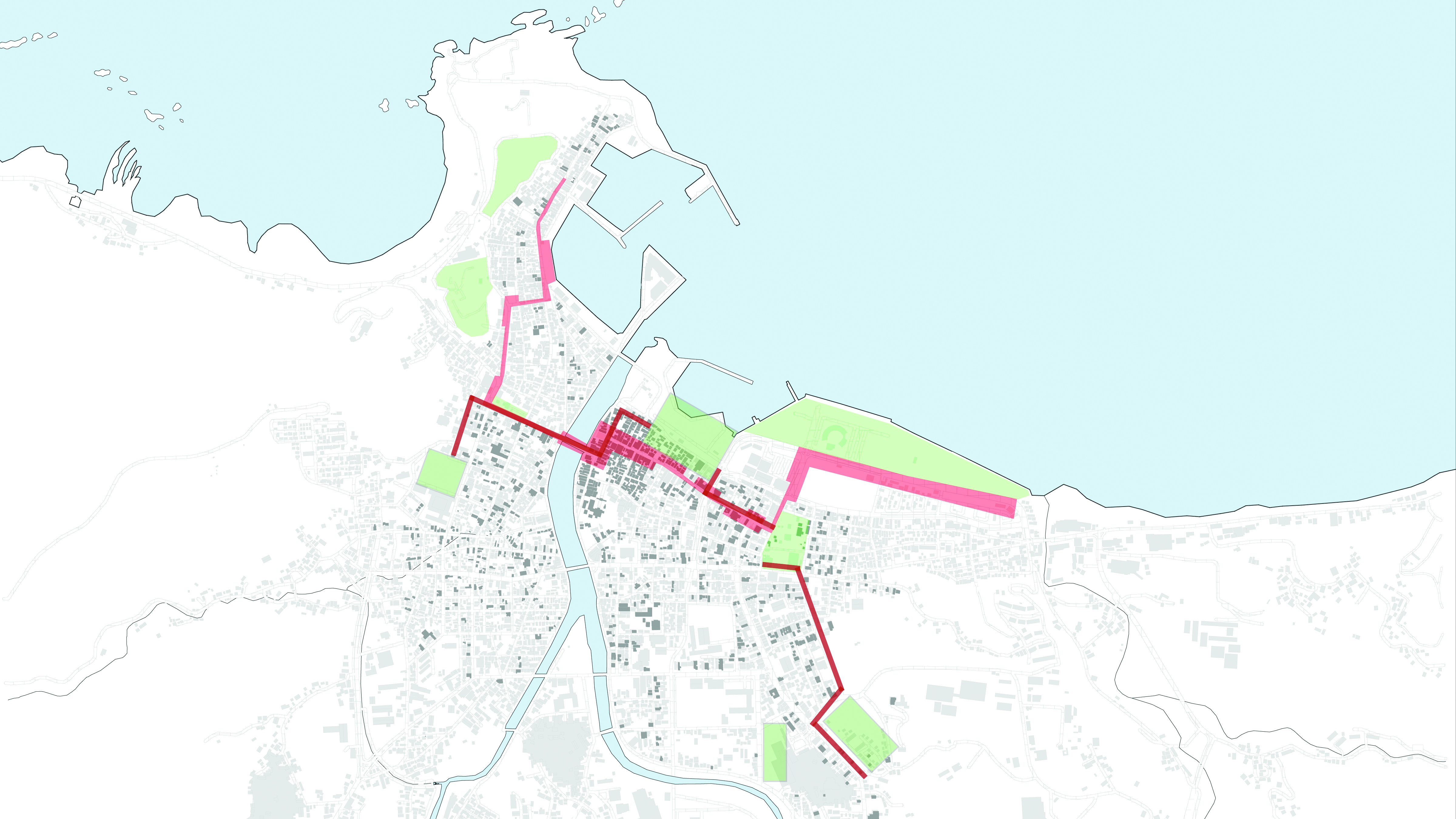
Suzu: Disaster Response Plan — Rebuilding the urban fabric farther from the coastline; repurposing coastal land as farmland and flood barrier.
Agriculture — Wagyu beef (ranch supply chain, farmstead-stay potential); Vegetables, rice & sake ("Noto Vegetables," GIAHS terraced fields); Seaweed & seafood (ama free-diving tradition, exceptional quality).
Craftwork — Wajima lacquerware (600 years, 100+ steps, gold-inlay chinkin); traditional crafts (36 nationally designated, incl. Kaga Yuzen, Kutani ware, gold leaf); forestry & woodworking (Edo-period roots, cedar and Hinoki cypress).
Sightseeing — Kiriko Festival (200+ celebrations, floats up to 15m); hot springs (Wakura Onsen, 1,200+ years); Senmaida rice fields (1,300 years, hand-farmed terraces).
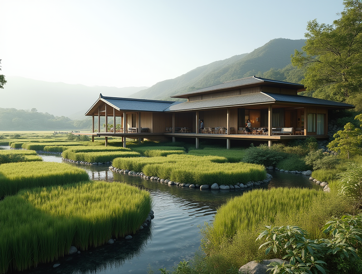
Eleven architectural speculations give the framework physical form: Flood Control Resort Villages, Culinary School & Urban Farm, New Morning Market & Community Center, New Wajima-Nuri School, New Jozu Shrine, Community Center/Emergency Shelter, New Wajima Train Station, Kiriko Craft Square, Urban Farm & Culinary Center, Kiriko Outdoor Museum, and Noto's Table: Culinary School & Restaurant.
Executive Producers: Eui-Sung Yi (Director, NOW Institute; Partner, Morphosis Architects), Paul Yoshitomi (NPO Rise w/Form Plus), Yoshihiro Ura (Counselor, City of Wajima). Urban Planning Research: USC School of Architecture. Design & Editing: Nippon Design Center — Daigo Daikoku, Hiroko Kusano, ZiZi Spak, Ken Isome.